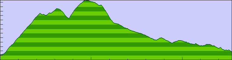
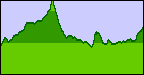
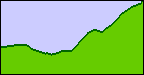
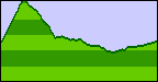
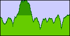
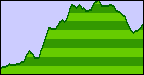
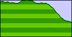
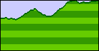
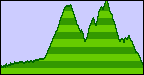
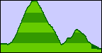
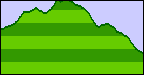
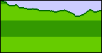
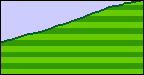
| 2711 feet (200 feet per division) |
|
| 25.48 miles |
Return to Santa Rosa Cycling Club.
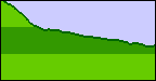
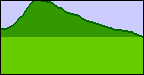
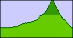
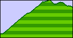
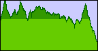
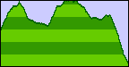
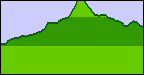
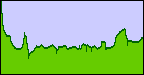
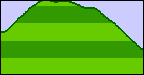
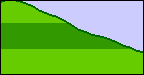
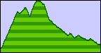
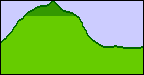
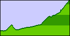
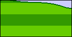
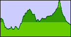
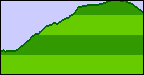
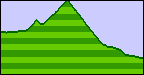
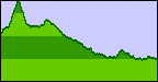
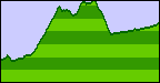
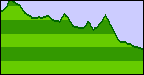
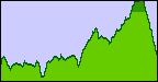
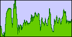
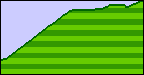
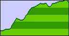
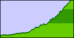
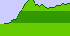
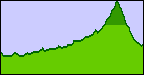
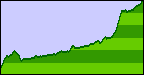
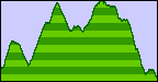
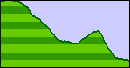
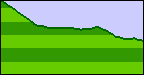
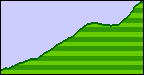
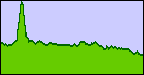
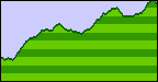
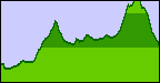
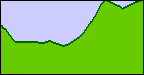
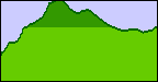
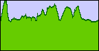
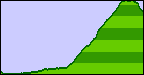
Graphs of altitude versus distance for popular bicycle routes in the vicinity of Sonoma County, California. These graphs are generated from GPS (Global Positioning Satellite) data recorded mostly by SRCC member Lou Salz. Lou's GPS receiver includes a barometric altimeter to supplement the satellite data when the satellites are obscured from view. More Details
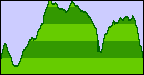
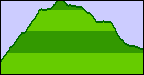
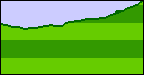
Click on a graphic to see the elevation profile:
 Annapolis Rd |
 Bay Hill Rd |
 Bittner Rd |
 Bohemian Hwy |
 Canyon Rd |
 Carmody Rd |
 Cavedale Rd |
 Chalk Hill Rd |
 Chileno Valley Rd |
 Coleman Valley Rd |
 Dutcher Creek Rd |
 Eastside Rd1 |
 Eastside Rd2 |
 Fort Ross Rd |
 Fort Ross Road |
 Fountain Grove Pkwy |
 Fountaingrove Pkwy |
 Franz Valley Rd |
 Geysers Road |
 Graton Rd-Frei Rd |
 Graton Rd |
 Graton Road |
 GrnVlyThomasMaddox |
 Harrison Grade |
 Hauser Bridge Rd |
 Hopland Grade |
 Hwy 128 Calistoga |
 Hwy 128 Cloverdale |
 Hwy 128 Yorkville |
 Hwy 1d |
 Hwy 1e |
 Hwy 1g |
 Hwy 1j |
 Ida Clayton Road |
 Joy Rd |
 King Ridge Rd |
 Los Alamos Rd |
 Main St-Bohemian Hwy |
 Mark West Springs Rd |
 Mays Canyon Rd |
 Meyers Grade |
 Mill Creek Rd |
 Mountain View Rd |
 Oakville Grade |
 Old Skaggs Springs |
 Pine Flat Rd |
 River Rd1 |
 Rockpile Rd |
 Seaview Rd |
 Skaggs Springs Rd |
 Skaggs Springs Road |
 Sonoma Mountain Rd |
 Sonoma Mt Rd |
 Spring Hill Rd |
 Trenton-Healdsburg Rd |
 Trinity Rd |
 Vine Hill Rd |
 Western Mine Rd |
 Westside Rd |
 Willow Creek Rd |